A BROAD swathe of inland Queensland is set to receive some handy top up rain later in the week, with a wet winter promised.
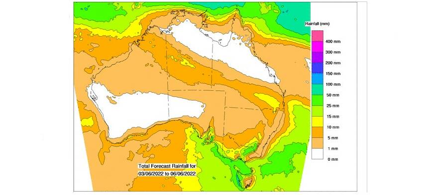
Latest Bureau of Meteorology mapping for the June 3 to 6 period shows 5-10mm of rain from the Northern Territory border right through to the southern Queensland coast.
Some parts of the Darling Downs could also get 15mm, which may be unwelcome in areas still trying to harvest crops, especially cotton.
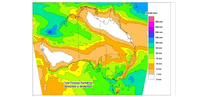
BoM's eight day mapping shows heavier rain for the top of half of Western Australia and parts of the Northern Territory as well as southern NSW and Victoria.

Patchy frosts are also tipped for the southern inland with temperatures near or below average.
On Wednesday, BoM says a trough over Western Australian is likely to bring increasing cloud to the far west of Queensland, with a slight chance of showers including the Granite Belt.
On Thursday there is a slight to medium chance of showers over south west Queensland, with a slight chance of showers again around the Granite Belt.

On Friday BoM says a weakening trough could move into the far west of Queensland with a slight to medium chance of showers in western and central Queensland and southern Queensland.
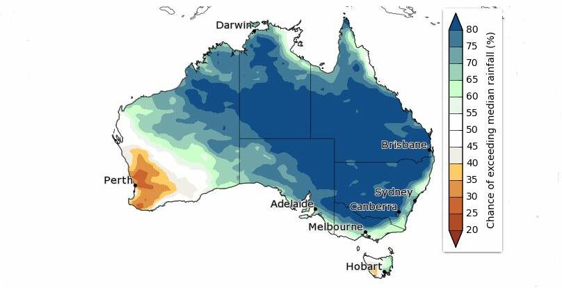
Rainfall during June to August is likely to be above median for much of Australia, with eastern and central regions very likely to exceed the median.
BoM says large parts of eastern Australia are two to three times more likely than normal to have unusually high rainfall during the June to August period.
Want daily news highlights delivered to your inbox? Sign up to the Queensland Country Life newsletter below.


