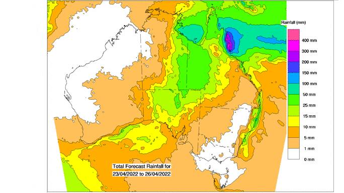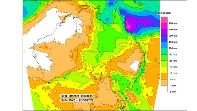
LATEST computer modelling from the Bureau of Meteorology shows good rain for a large parts of far western and far northern Queensland, extending into the Northern Territory starting from about Saturday.
The mapping (pictured above) shows the expected accumulated totals from April 23 to 26, with the best 25mm totals in the area of Queensland above the Australian border and on Cape York Peninsula.
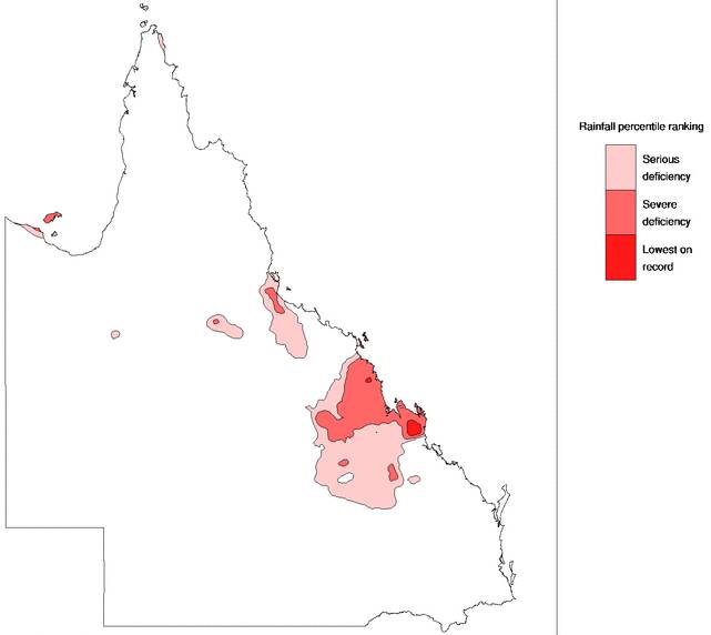
However, rain deprived areas of the north and central Queensland appear set to continue to miss out with Australia's official forecaster showing very limited activity heading into the cooler months.
The drier conditions will certainly be very welcome in many grain growing areas, where water logged conditions - particularly on the Darling Downs - had hampered machinery from getting onto paddocks. Cotton growers approaching picking are also keeping a wary eye on the skies, hoping for fine and dry conditions.

AgForce president Brendan Taylor said the Darling Downs had sufficiently dried out just in time for the start of the planting of winter crop in about two weeks time.
"There were some great drying conditions over Easter and we're been finally able to get machinery onto the paddocks," Mr Taylor said.
"Most farmers are out now going flat out chasing weeds, or continuing to harvest sorghum and mungbeans.
"There may be some discolouration and sprouting issues, but the sorghum being harvested is certainly delivering in terms of yield. There have also been some very good mungbean crops."
Mr Taylor said while the conditions on Downs were very encouraging for planting, grain growing areas further est and in central Queensland were still still chasing rain.

BoM's May outlook shows above median rainfall is also likely for most of NSW and across the border into southern Queensland.
Looking further forward, BoM says May to July rainfall is likely to be above median for most of Queensland, NSW, and the Northern Territory.
The bureau says climate outlooks continue to indicate a return to neutral El Nino-Southern Oscillation (ENSO) (neither La Nina nor El Nino) during late autumn or in early winter.
La Nina events increase the chances of above average rainfall across large parts of eastern Australia during autumn.
BoM says atmospheric and most oceanic indicators of ENSO currently continue to persist at La Nina levels, with sea surface temperatures remaining cooler than average along the equator. Trade winds also remain stronger than average in the western Pacific, BoM says.
Other atmospheric indicators include decreased cloudiness persisting along the Date Line and a positive Southern Oscillation Index.
BoM says the Madden-Julian Oscillation has also been weak or indiscernible for the past fortnight, the Southern Annular Mode index is positive, but is expected to be neutral to weakly positive over the coming two weeks, and the Indian Ocean Dipole is neutral.
Want daily news highlights delivered to your inbox? Sign up to the Queensland Country Life newsletter below.


