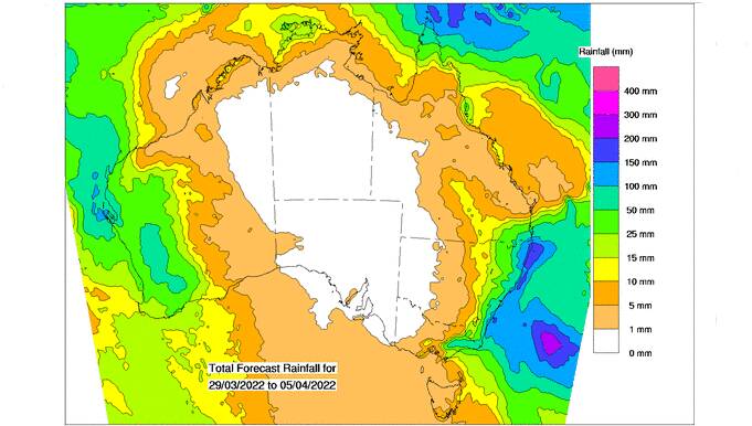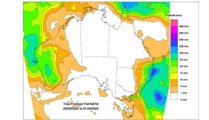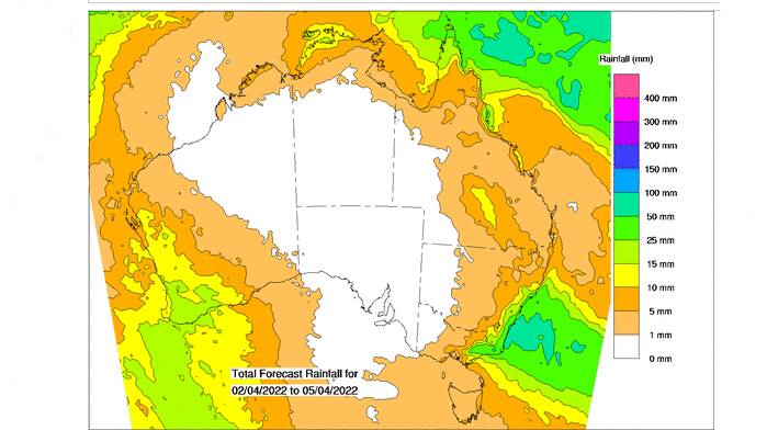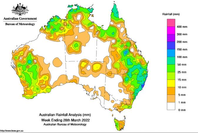
ALREADY saturated parts of Queensland are set for more rain, particularly in the south east corner.
While NSW is now copping the brunt of the ongoing wet weather, the rain is playing havoc with crops across big areas of southern Queensland, particularly on the Darling Downs and other key production areas including the Lockyer Valley.
The latest eight day mapping from the Bureau of Meteorology shows accumulated totals in the 10-25mm range, which may continue to keep the ground wet and machinery off paddocks.
While is the floods that are making headlines, of particular concern is the forecasts are less than encouraging for central Queensland, where the season is extremely patchy heading into winter.

Peter Waddell, Nyerin, Jondaryan, said two big floods in a month had been a major disruption during the peak summer crop harvest period on the central Darling Downs.
"We were able to harvest about 450ha of the early planted crop so we're not too bad, but there is about a further 200ha that we can't get to," Mr Waddell said.
"We're hopeful that 350ha of late planted sorghum will be okay."
Nyrein measured more than 200mm for the week
At Maryborough, Butch Titmarsh said the the family property Tandora at the mouth of the Mary River was enjoying an excellent season.
"We were just on the northern edge of all the heavy rain," Mr Titmarsh said.

"During the past two flood events we received 100mm each time, which was just wonderful for this country.
"Now we're slashing the paddocks to freshen up the grass for the cattle.
"The risk is with a dry winter and dry spring, Queensland could be facing the biggest fire risk it has ever seen."
Drier conditions could be on the way with BOM reporting the 2021-22 La Nina event had weakened slightly during the past fortnight, indicating a return to neutral El Nino-Southern Oscillation (ENSO) levels - neither La Nina nor El Nino-late in the southern hemisphere autumn.

La Nina events increase the likelihood of tropical cyclones within the Australian region, as well as increasing the chances of above average rainfall across large parts of eastern Australia during autumn. El Nino events have the opposite effect.
BOM says rainfall across northern Australia during the October to April wet season had increased since the late 1990s.
"In recent decades there has been a trend towards a greater proportion of rainfall from high intensity short duration rainfall events, especially across northern Australia," BOM says.
Want daily news highlights delivered to your inbox? Sign up to the Queensland Country Life newsletter below.


